Hotel Schmitz prior to 1940
Courtesy of Archives of Hosingen, Luxembourg

Hotel Schmitz in 1945
Note sandbags are still in the windows.
Courtesy of Archives of Hosingen, Luxembourg

Postcard of Hosingen’s main square prior to 1930
Hosingen 12th century church and Hotel Schmitz (building on the far right). The north section (right) of church was known as the Sister House.
Courtesy of Yves Rasqui

Hosingen’s main square in 1945
Hosingen 12th century church and Hotel Schmitz in ruins.
Courtesy of Archives of Hosingen, Luxembourg

Hotel Schmitz on the left, next to house Petesch; 1945
Courtesy of Archives of Hosingen, Luxembourg

Interior of Hosingen’s church before WWII.
Courtesy of Archives of Hosingen, Luxembourg

The interior of the church looking towards the altar in 1945
Courtesy of Archives of Hosingen, Luxembourg

The interior of the church looking toward the exit in 1945.
Courtesy of Archives of Hosingen, Luxembourg

Northern section of the church known as the 'Sister House' in 1945.
Courtesy of Archives of Hosingen, Luxembourg

Kraeizgaass (street) – building of the fire brigade and farm Berscheid in 1945.
Courtesy of Archives of Hosingen, Luxembourg

Kraeizgaass (street) – view from Hotel Schmitz in 1945
Courtesy of Archives of Hosingen, Luxembourg

View of main street looking in the direction of the main square in 1945
Courtesy of Archives of Hosingen, Luxembourg

Kraeizgaass (street) on the south side of the church – view of the main street in 1945
Courtesy of Archives of Hosingen, Luxembourg

View of Kraeizgaass (street) – house Dohm-Atten in 1945; post-war it is house #22
Courtesy of Archives of Hosingen, Luxembourg

View from Kraeizgaass (street) of farm Rodesch in 1945
Courtesy of Archives of Hosingen, Luxembourg

An der Méilchen (street) on west side of Hosingen; farm Hoscheid-Weiler in 1945; post-war it is house #21
Courtesy of Archives of Hosingen, Luxembourg

Postcard of Hotel Hippert at intersection of Haaptstrooss & Holzbicht, after 1920
Across the street from K Co., 110th IR command post in pharmacy.
Courtesy of Archives of Hosingen, Luxembourg

Hotel Hippert at intersection of Haaptstrooss & Holzbicht in 1945
Across the street (west) from K Co., 110th IR command post in the pharmacy.
Courtesy of Archives of Hosingen, Luxembourg

View of Kraeizgaass (street) south of the church – farm Peters in 1945; post-war it is house #32
Courtesy of Archives of Hosingen, Luxembourg

Main street house Kaiser-Kipgen by Oberlinkels J.P. in 1945
Courtesy of Archives of Hosingen, Luxembourg

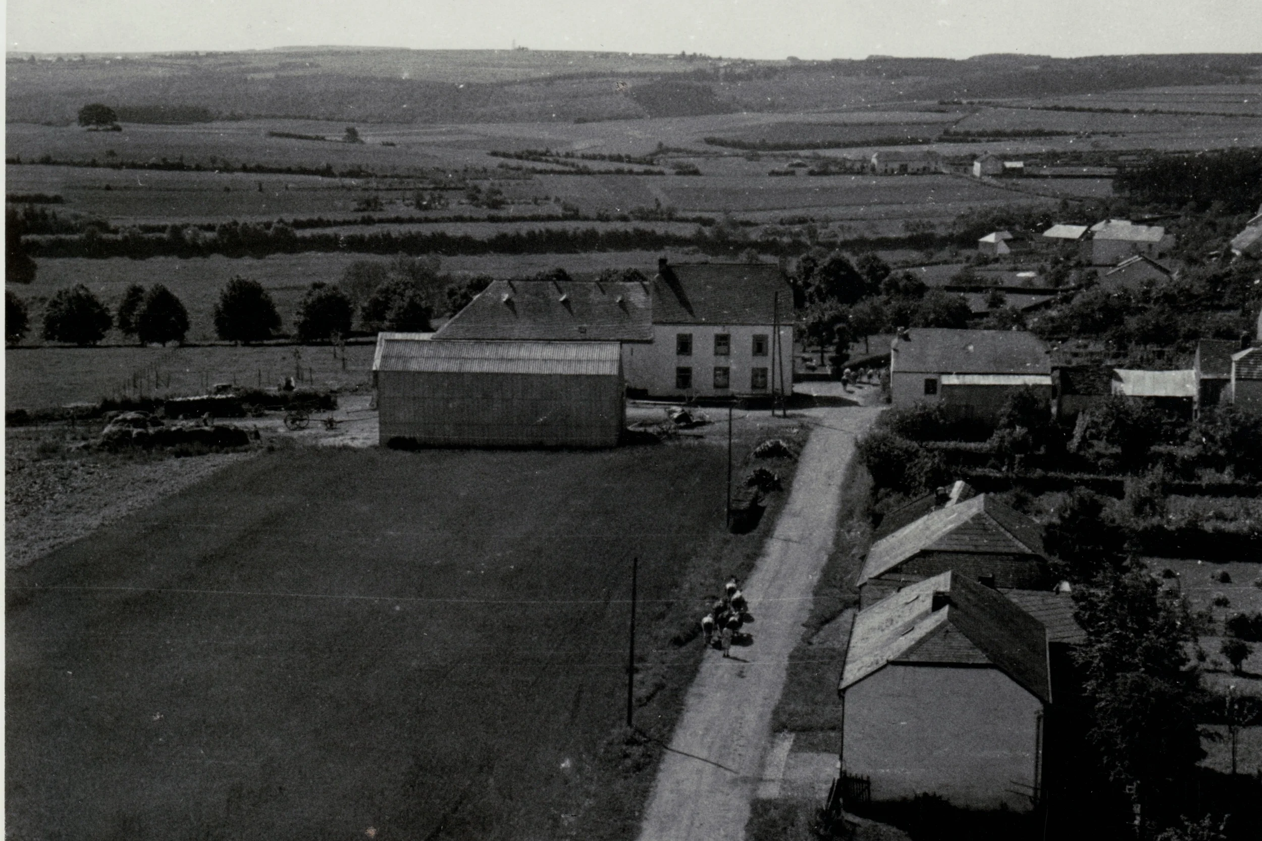
NW view from Hosingen water tower. Overlooks K Co.’s 1st platoon CP on north end of Hosingen –
Café Beyrisch and barn Heutz-Arend (about 1944)
Courtesy of Archives of Hosingen, Luxembourg

NW view from Hosingen water tower in the direction of Dorscheid, prior to 1944.
Skyline Drive runs through the lower half of the photo –
K Co.’s 1st platoon command post in the farmhouse was just to the left of the photo.
Courtesy of Archives of Hosingen, Luxembourg

Left: Chapel–cemetery in the southeast of Hosingen; 1945
Courtesy of Archives of Hosingen, Luxembourg
Right: Hosingen water town used as K Co.’s 1st Platoon’s northern observation post; pre-WWII photo
Courtesy of Yves Rasqui

Hosingen's water tower in ruins in 1945
Courtesy of Archives of Hosingen, Luxembourg

An der éweschter Gâss (street) – view towards the church in 1945
Courtesy of Archives of Hosingen, Luxembourg

An der éweschter Gâss (street) – House Nic. Oberlinkels; 1945
Courtesy of Archives of Hosingen, Luxembourg

NE view from Hosingen water tower prior to 1944
Our River valley looking east towards Grovenbérg Fallbich and Preischeid, with Germany in the far background
Courtesy of Archives of Hosingen, Luxembourg

View south from water tower of Op dem Knupp (street); pre-WWII
House on the left is house Schmitz and house on the right is house Kaiser
Courtesy of Archives of Hosingen, Luxembourg

View of Op dem Knupp (street) to the south of the water tower; 1945
You can see destroyed houses; house on the left is house Schmitz and house on the right house Kaiser.
Courtesy of Archives of Hosingen, Luxembourg

Haus Schmitz, prior to 1944
Courtesy of Archives of Hosingen, Luxembourg

Op dem Knupp (street)–Haus Schmitz after 1945, viewed from direction of Graaf
Courtesy of Archives of Hosingen, Luxembourg

Holzbicht (street) – House Ludwig; 1945
Courtesy of Archives of Hosingen, Luxembourg

Café de la Post in 1945; today Café des Sports, #42
Courtesy of Archives of Hosingen, Luxembourg

House Ludwig on Holzbicht (street); 1945
Courtesy of Archives of Hosingen, Luxembourg

Main street in direction Duurchfaart (street); 1945
Courtesy of Archives of Hosingen, Luxembourg

Durchfaart (street) – view east from main street by Hotel Schmitz; 1945
Courtesy of Archives of Hosingen, Luxembourg

Durchfaart (street) – view west from house Meyer Anton in the direction of the main street; 1945
Courtesy of Archives of Hosingen, Luxembourg

House Welter-Weydert on Holzbicht (street); 1945
Courtesy of Archives of Hosingen, Luxembourg

Pre-WWII view of Hosingen from Steinmauer Hill
Hosingen's water tower is seen in the top right corner, approximately 1 km away.
Courtesy of Archives of Hosingen, Luxembourg

Pre-WWII postcard view of Hosingen from Steinmauer Hill
Church steeples are in the center
Courtesy of Archives of Hosingen, Luxembourg

Post war view of Hosingen from Steinmauer Hill; 1945
Church steeples in the center have been destroyed
Courtesy of Archives of Hosingen, Luxembourg

Farm Honicht to the east of Hosingen; 1945
Courtesy of Archives of Hosingen, Luxembourg

Farm Honicht to the east of Hosingen; 1945
Courtesy of Archives of Hosingen, Luxembourg


